


© 2025 WADI e.V.
Webdesign by Nyx Alexander Design
he
historical
origins
of
Koya
remain
unclear
so
far,
although
there
are
archaeological
hints
that
Koya
and
its
surroundings
used
to
be
a
Christian
regional
centre
–
a
bishop
see
–
in
the
period
from
the
3rd
to
7th
century
AD.
Later
medieval
periods
represent
a
‘Dark
Age’
in
the
history
of
the
town.
One
can
only
speculate
that
since
the
1530s
the
district
(sanjaq)
of
Koya
played
important
role
in
the
Ottoman
borderland
protection
policy.
In
the
mid-
eighteenth
century,
Koya
was
already
considered
the
largest
and
most
powerful
Kurdish
principality
in
Iraqi
Kurdistan,
even
extending
its
power
over
the
Erbil
and
Altun
Köpri
districts.
The
power
of
the
town
stemmed
not
only
from
its
strategic
position
and
political
role
but
also
from
developed
agricultural
production
and
commerce,
which
included
also
special
goods
like
tobacco.
At
the
beginning
of
the
19th
century,
the
number
of
inhabitants
of
Koya
was
estimated
surprisingly
high
–
12.000
according
to
British
traveler
William
Heude.
According
to
the
location
of
the
oldest
dated
landmarks
in
the
city
plan,
we
can
conclude
that
the
mid-nineteenth
century
was
a
key
period
of
the
urban
growth
and
that
roughly
all
areas
of
the
present-day
urban
nucleus
have
been
already
occupied
in
the
first
half
of
the
nineteenth
century.
In
1847,
the
Ottomans
took
over
direct
control
of
the
town,
and
the
commercial
character
of
Koya
has
been
even
stressed
as
a
consequence
of
the
Tanzimat
policy,
which
intended
to
tie
the
remote
provinces
closer
to
the
capital.
Since
the
1960s
when
Koya
was
identified
as
one
of
the
centres
of
the
Kurdish
nationalistic
uprising,
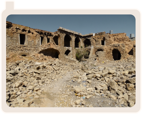
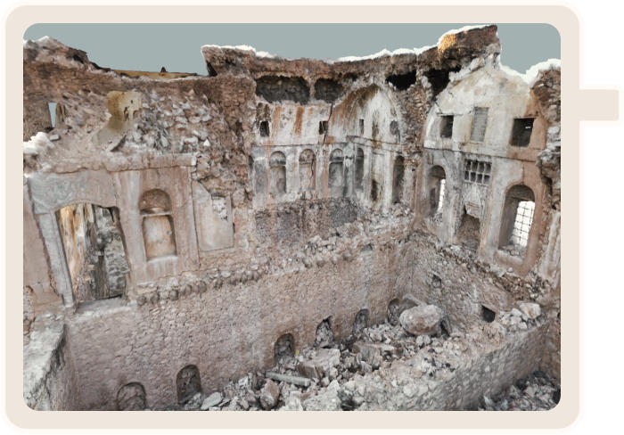
its
city
suffered
many
losses
caused
by
both
direct
military
operations
and
administratively-based
reconstruction
obstacles.
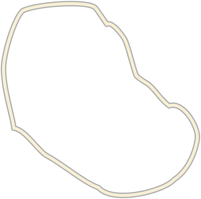
The
27-
hectare
core
of
the
oval
plan,
situated
on
the
south-eastern
slope
and
annexed
to
the
Koya
stream
terrace
edge,
was
originally
fortified
by
a
wall
punctuated
with
four
gates,
according
to
the
local
historical
tradition.
The
wall
had
gone
out
of
use
at
the
beginning
of
the
19th
century
and
was
gradually
removed.
The
main
streets
used
to
connect
the
gates
with
the
central
commercial
node
situated
in
the
area
among
the
Grand
Mosque,
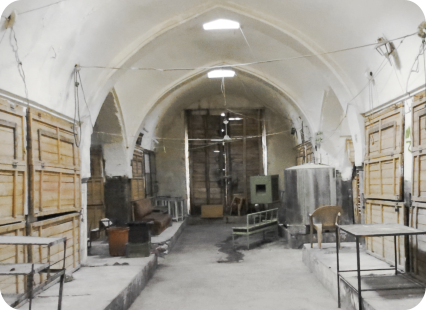
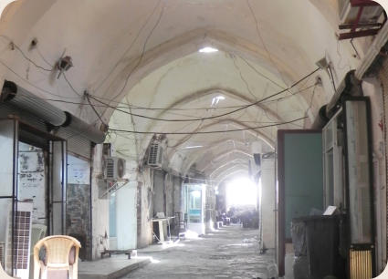
the
bazaar
with
its
two
qaysariyas
and
khans.
The
axial
road
running
from
the
south
gate
to
the
north-west
presumably
represented
the
once
most
important
corridor.
In
a
later
phase,
probably
after
the
removal
of
gates,
its
importance
might
have
been
overshadowed
by
a
commercial
thoroughfare
coming
from
the
southeast,
as
the
orientation
of
qaysariyas
followed
its
direction
and
khans
were in touch with it.
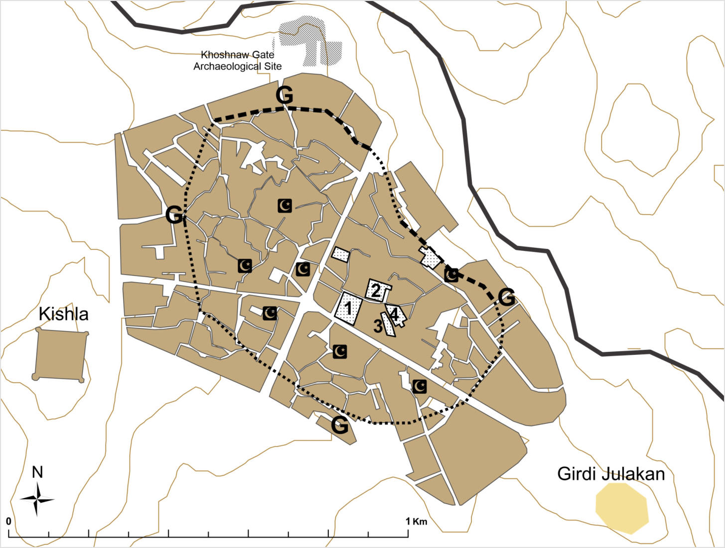


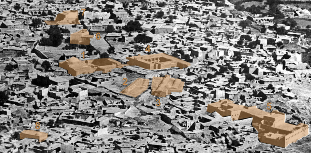
1 – Great Mosque
(1844 AD)
2 – Old Qaysariya
(1840 AD)
3 – New Qaysariya
(1906 AD)
4 – Mahmud Agha Khan
(1277 H, 1861-62 AD)
5 – Jameel Agha House
6 – Murad Agha House
7 – Rasul Agha House
(1885 AD)
8 – Mar Yusif Church


")